What is CSB?
Welcome to the world of crowdsourced bathymetry (CSB), where collective efforts can help shape our understanding of the depths in our coastal zones, oceans, lakes, and waterways. This approach harnesses the power of individuals and organizations worldwide to contribute to and create cost-effective bathymetric maps and products.
Volunteer data from any ship with an echo sounder or fish finder can be used – which many vessels likely already have. Routinely measured parameters, such as under keel depth and position, can be stored, uploaded and contributed from either an Electronic Chart System participating in the IHO CSB Initiative or through a variety of data loggers that can be interfaced to the ship’s NMEA data bus. There are several data loggers and systems that are currently being used in the Initiative and others that are currently under development.
This information can then be shared through dedicated platforms or applications, where it is collated and made available to the community via the IHO Data Center for Digital Bathymetry (DCDB) to be used for a variety of purposes. By contributing data to the IHO DCDB, the provider will not be held liable for the data submitted.

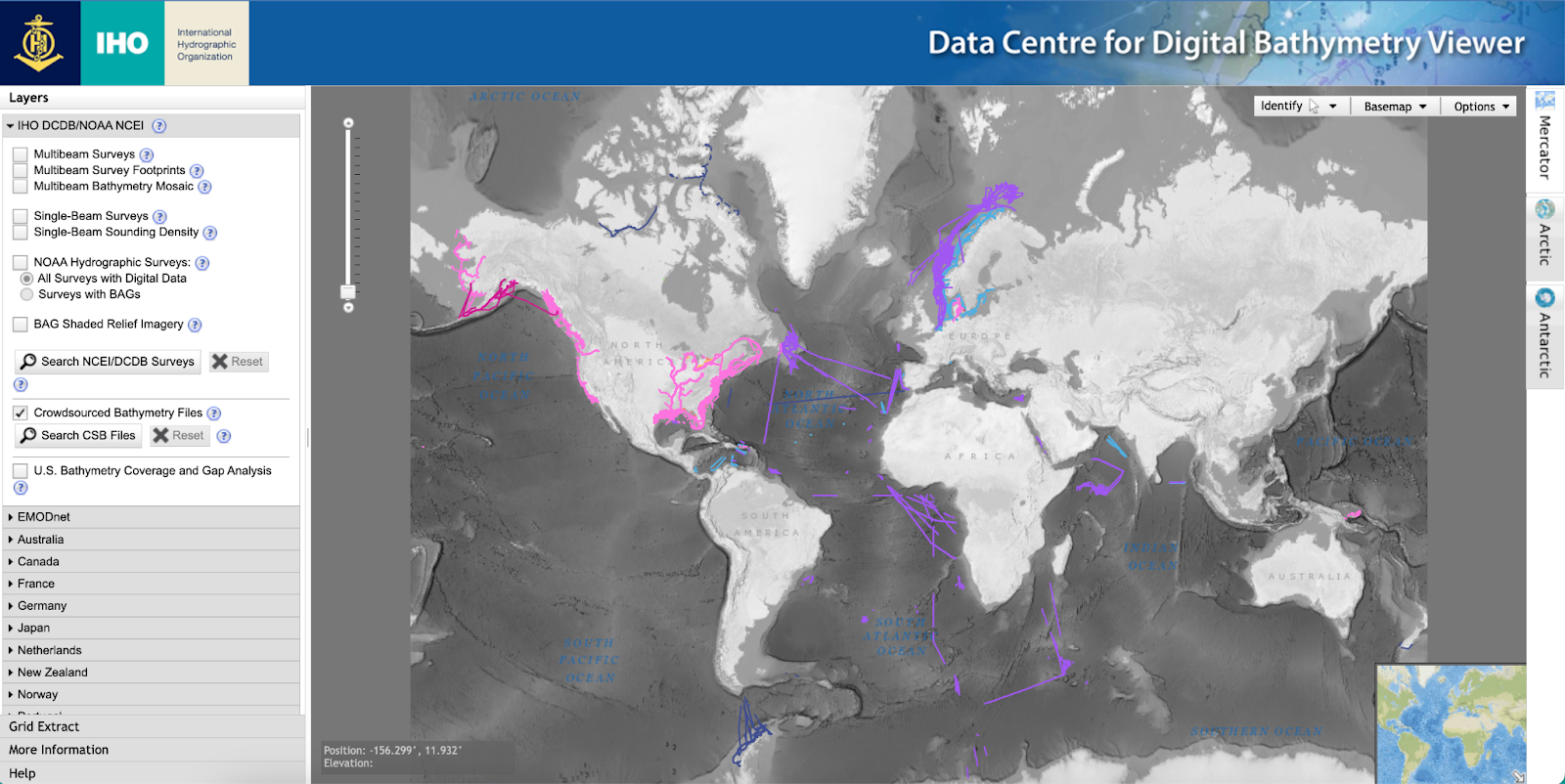
The International Hydrographic Organization (IHO) has a long history of encouraging the collection of CSB to help improve mankind’s understanding of the shape and depth of the seafloor. For over a century, maps of the ocean floor were created from depth measurements collected by vessels as they journeyed across the oceans. These “passage soundings” have enabled the creation of progressively more detailed seafloor maps and digital data grids. More recently, systematic surveys have also been used to improve the maps and grids. Unfortunately, despite the multitude of data that has been collected since 1903, only 25% of the world’s ocean depths have been measured; the rest of the data used to compile seafloor maps are estimated depths.
This IHO CSB Initiative was born in 2014 at the Fifth Extraordinary International Hydrographic Conference to improve the collection, quality and availability of hydrographic data worldwide. A working group was established that went on to prepare a new IHO publication on policy for crowdsourced bathymetry (B-12 IHO Guidance on Crowdsourced Bathymetry) that provides best practices for collecting and contributing crowdsourced bathymetry.
Participation from non-traditional survey vessels is critical! This data will ultimately support the conservation and sustainable use of the world’s oceans in support of the UN Decade of Ocean Science for Sustainable Development (2021-2030), UN Sustainable Development Goal 14 (Life Below Water) and the Nippon Foundation-GEBCO Seabed 2030 global mapping initiative.
The growing adoption of CSB brings forth numerous advantages. These data can contribute to improved bathymetric maps or hydrographic charts in previously uncharted areas or those lacking accurate data. This is particularly beneficial for regions with limited financial resources or access to specialized survey vessels.
CSB data can enhance navigational safety by providing up-to-date information on water depths, shoals, and potential hazards. It contributes to environmental conservation efforts by identifying critical habitats, monitoring erosion, and studying underwater ecosystems. Additionally, CSB supports research on climate change impacts, coastal zone management, and disaster preparedness, empowering informed decision-making and risk mitigation.
CSB efforts can also foster community engagement, encourage public participation in scientific endeavors and promote responsibility towards our water resources.